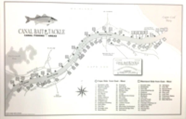
Canal Map
Unlock the secrets of the world’s most intense saltwater fishery with the official
Whether you’re fishing the North (Mainland) or South (Cape) side, this map lays out 55 proven fishing spots spanning the entire length of the waterway—from the Buzzards Bay entrance all the way to Cape Cod Bay.
Why Anglers Trust the Canal Bait & Tackle Fishing Map:
-
Complete Both-Sides Coverage: Gain immediate visual knowledge of key access points, prominent rips, drop-offs, and productive current structure along both the Cape and Mainland shores.
-
Exact Pole Number References: The Canal is laid out by Army Corps service pole markers. Our map maps directly to these pole numbers, making it effortless to pinpoint exact locations, coordinate with fishing buddies, or navigate to exact spots in low-light conditions.
-
Spread Out & Find Open Water: Instead of crowding into famous bottleneck spots like Pole 20, use this detailed guide to explore dozens of under-fished, highly productive locations scattered along the banks.
-
Durable & Easy-to-Read Design: Engineered to replace outdated, hard-to-read charts, this redesigned layout gives you clear visual reference points whether you’re planning your trip at home or checking your route on the tailgate before an early-morning tide.
Stop guessing where the fish are staging during a tide change. Pick up your Cape Cod Canal Fishing Map today, gear up at